


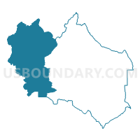
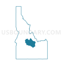
Stanley Voting District, Custer County, Idaho
About
Outline

Summary
| Unique Area Identifier | 564006 |
| Name | Stanley Voting District |
| County | Custer County |
| State | Idaho |
| Area (square miles) | 1,407.39 |
| Land Area (square miles) | 1,398.37 |
| Water Area (square miles) | 9.02 |
| % of Land Area | 99.36 |
| % of Water Area | 0.64 |
| Latitude of the Internal Point | 44.33633680 |
| Longtitude of the Internal Point | -114.81380120 |
Maps

Graphs
Select a template below for downloading or customizing gragh for Stanley Voting District, Custer County, Idaho


Neighbors
Neighoring Voting District (by Name) Neighboring Voting District on the Map
- Atlanta Voting District, Elmore County, ID
- Clayton Voting District, Custer County, ID
- Lowman Voting District, Boise County, ID
- Mineral Hill Voting District, Lemhi County, ID
- Ne Blaine County Voting District, Blaine County, ID
- Nw Ketchum Voting District, Blaine County, ID
- Round Valley 2 Voting District, Custer County, ID
- Yellow Pine Voting District, Valley County, ID
Top 10 Neighboring County Subdivision (by Population) Neighboring County Subdivision on the Map
- Ketchum CCD, Blaine County, ID (6,620)
- Challis CCD, Custer County, ID (2,614)
- Garden Valley CCD, Boise County, ID (1,863)
- Stanley CCD, Custer County, ID (333)
- Atlanta CCD, Elmore County, ID (290)
- Forney CCD, Lemhi County, ID (49)
- Stibnite CCD, Valley County, ID (41)
Top 10 Neighboring Place (by Population) Neighboring Place on the Map
Top 10 Neighboring Unified School District (by Population) Neighboring Unified School District on the Map
- Mountain Home School District 193, ID (24,115)
- Blaine County School District 61, ID (21,376)
- McCall-Donnelly Joint School District 421, ID (7,552)
- Salmon School District 291, ID (7,154)
- Challis Joint School District 181, ID (3,104)
- Cascade School District 422, ID (2,410)
- Garden Valley School District 71, ID (1,961)
Top 10 Neighboring State Legislative District Lower Chamber (by Population) Neighboring State Legislative District Lower Chamber on the Map
- State House District 35, ID (43,409)
- State House District 25, ID (43,165)
- State House District 8, ID (38,711)
- State House District 22, ID (34,066)
Top 10 Neighboring State Legislative District Upper Chamber (by Population) Neighboring State Legislative District Upper Chamber on the Map
- State Senate District 35, ID (43,409)
- State Senate District 25, ID (43,165)
- State Senate District 8, ID (38,711)
- State Senate District 22, ID (34,066)
Top 10 Neighboring 111th Congressional District (by Population) Neighboring 111th Congressional District on the Map
Top 10 Neighboring Census Tract (by Population) Neighboring Census Tract on the Map
- Census Tract 9502, Boise County, ID (7,028)
- Census Tract 9602, Custer County, ID (4,368)
- Census Tract 9603, Blaine County, ID (3,676)
- Census Tract 9601, Elmore County, ID (2,797)
- Census Tract 9701, Valley County, ID (2,627)
- Census Tract 9701, Lemhi County, ID (2,487)
Top 10 Neighboring 5-Digit ZIP Code Tabulation Area (by Population) Neighboring 5-Digit ZIP Code Tabulation Area on the Map
- 83340, ID (4,682)
- 83226, ID (2,504)
- 83611, ID (2,453)
- 83637, ID (206)
- 83278, ID (186)
- 83227, ID (142)
- 83601, ID (41)